Back to Burney: Facing the places that scared me
I wake to the sound of rain pitter pattering on my tent. This is surprising because just before bed I had a nice dip in Twin Lake, dried off in the warm sunshine and went to sleep under clear skies. I am camped two thirds of the way between Burney Falls and Chester in Lassen Volcanic National Park at 6500 feet. This is probably just mountain weather, but I sit up to close the zipper on my rain fly and check the weather forecast.
Last spring, I finished the 478 mile southern section of the PCT from the Mexico border up to Green Valley, where I had gotten off trail in October 2024. I thought that would be the end of it for me until I remembered the section I had skipped in Northern California. On September 9, 2024, I had staggered into Burney Falls State Park after several weeks of camping alone, being constantly fearful of mountain lions, and having noticed my grief process around my mother’s death morph into something more like a wet, heavy, blanket of depression. I had watched a man pull his pants down and urinate right in front of me and gotten a creepy hitch into town from a man who circled back to look for me later. The state park was closed down, and I couldn’t even view the famous Burney Falls. All in all, my outlook was grim, my state of mental health was fragile, and I was either going to abandon the trail completely or skip down to meet up with some hiker friends that I knew were ahead of me. I chose to skip 260 trail miles to get to the town of Truckee and resume my hike at Donner pass. I never wanted to see Burney California again.
One thing I know for sure about myself is that I am a person who likes to finish things. I like to get to the top of mountains, hike a full loop or complete a point to point hike. I like certificates of completion, degrees, graduations and I can’t stand half read books on my bedside table. Once I finished the larger southern California section, the memory of the smaller, unfinished northern California section came back into view, and I found that I did not feel my PCT was complete without hiking it. I wanted to see the whole thing. I wanted to walk the whole distance, and when I say I hiked the PCT, I want it to mean all of it.
So I set my sites on September and began making plans.Things seem to have lined up perfectly with a trail partner able to start with me and hike about half of these 260 miles with me. I picked Kurt up in Portland on my way south, and we drove all the way to the Burney Mountain Guest Ranch, a place I had heard about last year, but never saw. We found it to be beautiful, welcoming, and clean. The day before we started our hike we visited the famous Burney waterfall and hiked the short circuit with excellent views of the falls. I see now why it is so famous!
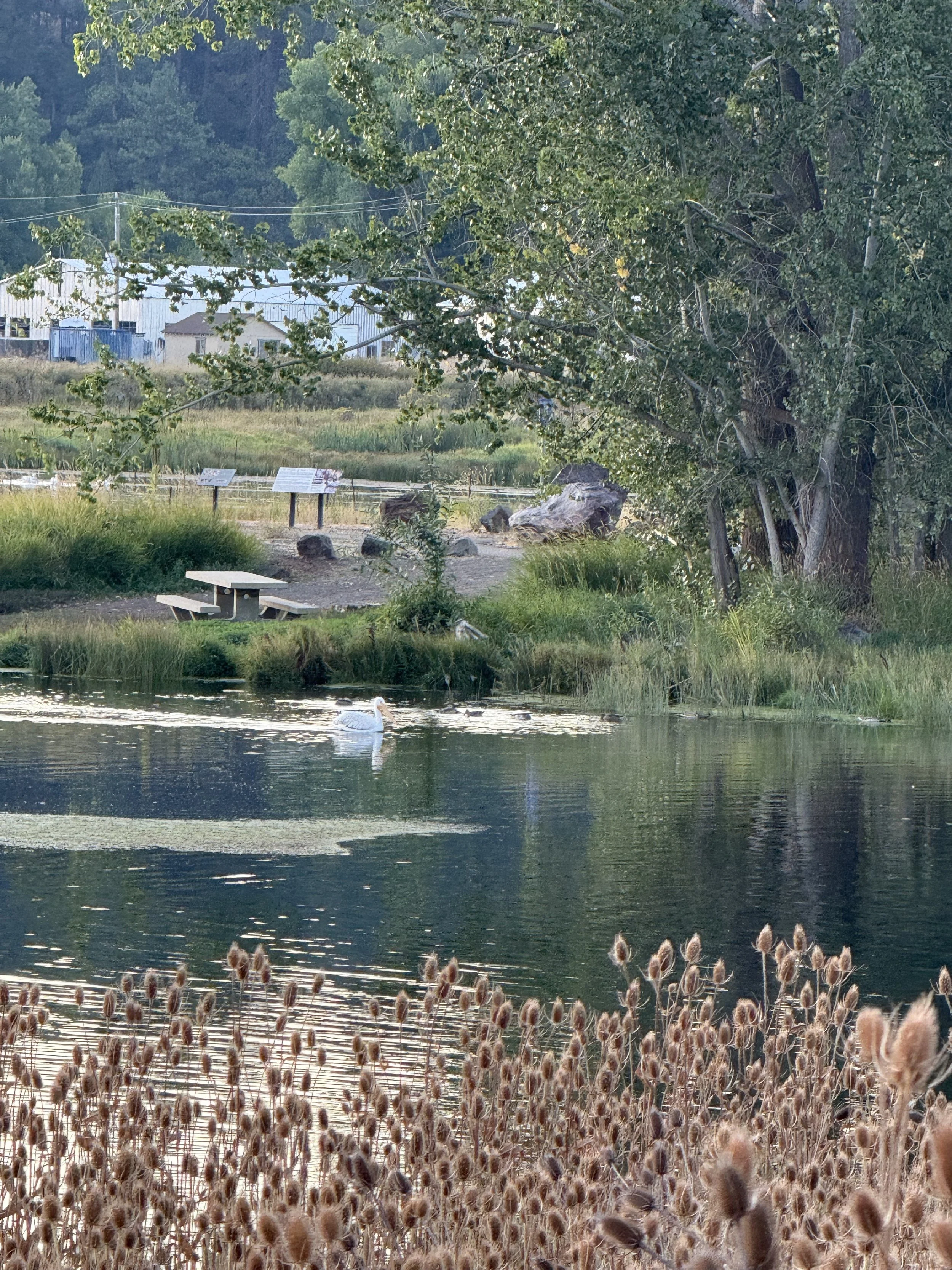
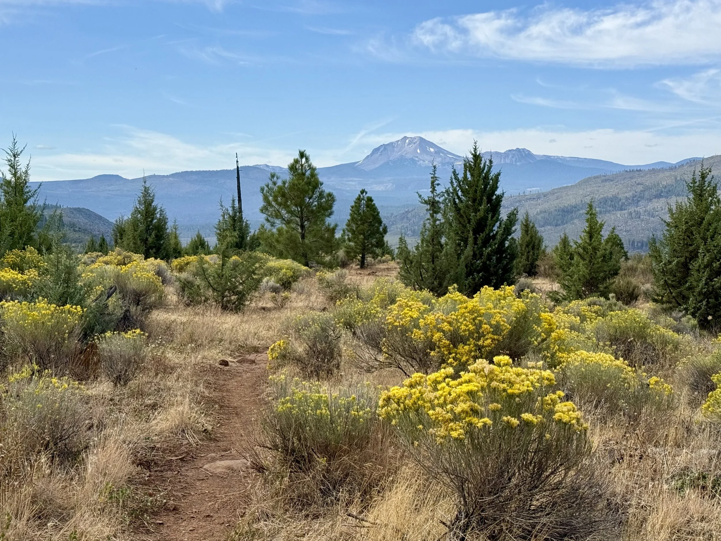
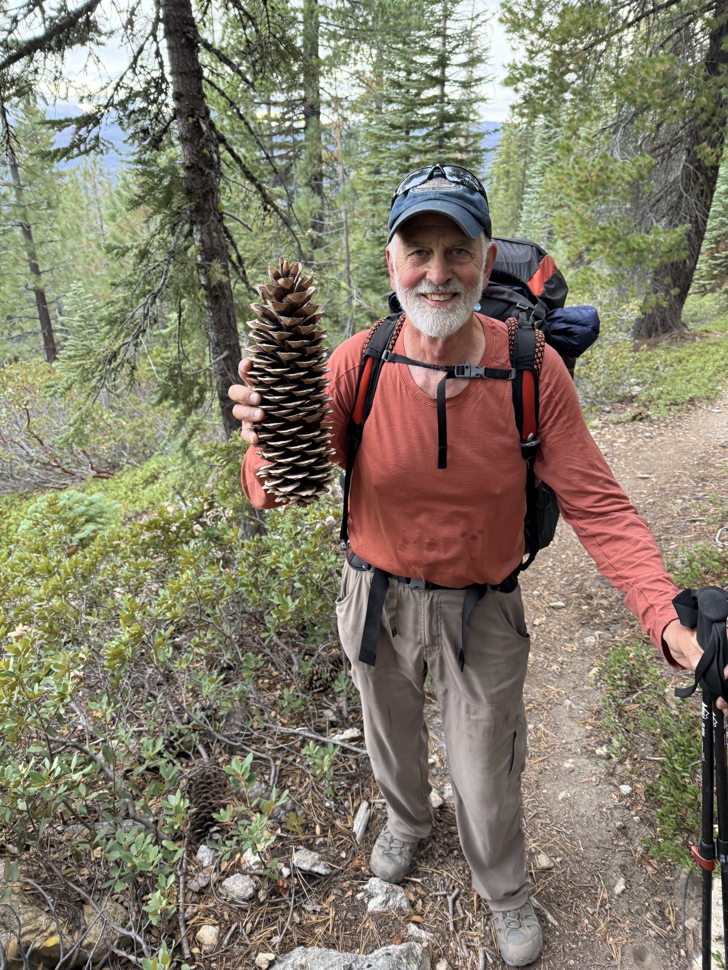
Based on the lens I was looking through last year, I had gotten the impression that this section of trail would be a bit of a chore and not very interesting. The Nor-Cal blues are real thing for hikers. Thru hikers have been on the trail for over 1200 miles and have not even crossed the halfway point yet. However, as is almost always the case, I was pleasantly surprised. Within the first 3 miles of day one we came to the Crystal Lake Fish Hatchery at sunrise and were treated to an amazing display of osprey, bald eagles, pelicans and great blue herons fishing for their breakfast. We walked along Hat Creek Rim, a natural geological fault line where a block of earth has settled 1000 feet creating a huge rock escarpment with views of Mount Shasta to the north and Lassen volcano to the south.
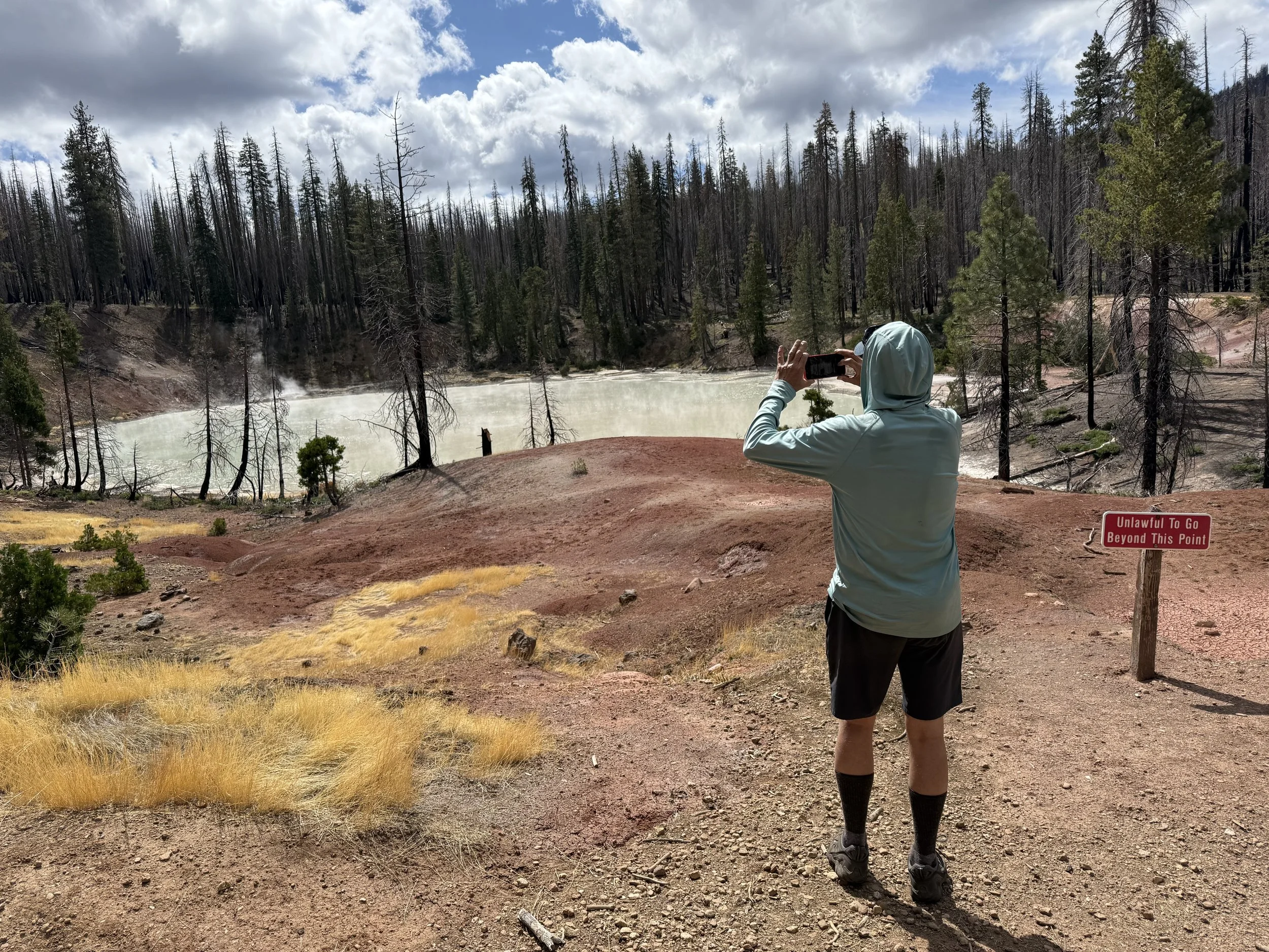
On day three we entered the Lassen Volcanic National Park, with Mt. Lassen, an active volcano, having last erupted in 1921. You can still see steaming pots and smell sulfur throughout the park. This area also marked the beginning of the Dixie fire burn scar. The Dixie fire burned almost 1,000,000 acres in 2021 and is the largest single source wildfire in California history. The Pacific Crest Trail winds in and out of this burned area for over 100 miles.
Hiking this section of trail, I am so aware of how different the lens is that I am looking through. I am in a much different place with regard to my grief process, and it has made a huge difference to have Kurt with me as a trail partner and friend. Another thing I have learned about myself is that I don’t like backpacking alone! Call me stubborn, call me a slow learner, it only took me 2400 miles to admit this to myself.
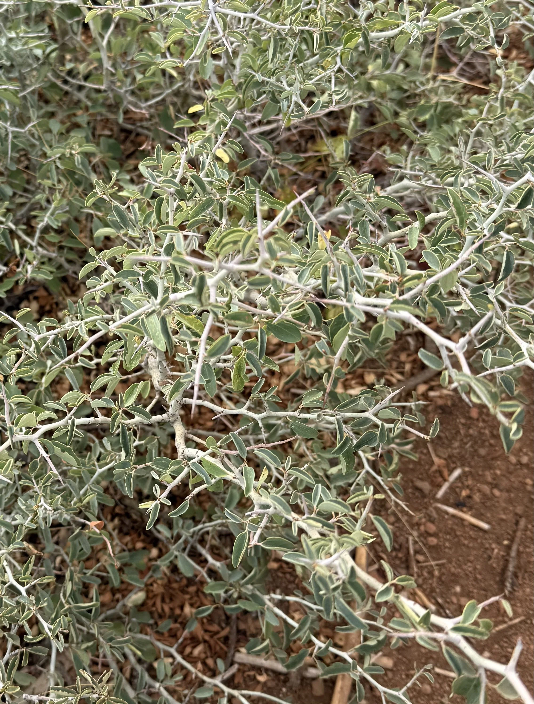
By morning on day four, the rain had stopped, and we set off under intermittent cloud cover with cool temperatures. It is interesting to hike through forests with huge burn scars, and then suddenly an area of live trees and then back into dead trees. We are lucky that a tremendous amount of trail clearing has been completed making our progress so much easier than it would have been. This was a very hot fire, burning out the root systems of trees. The standing dead trees can come down at any moment and will continue to do so until they have all fallen. We encounter a new plant on our final two days of this section. It’s called Mountain Whitethorne, and it is appropriately named, although I couldn’t help thinking of it as Devil’s Snare. It is mean, spiky and growing right into the center of the trail, where it grabs and scratches our ankles even through long pants and tall socks as we pass by. It seems to do well in these burned areas, so I expect we have not seen the last of it. And still, I am feeling happy and satisfied as the highway comes into view, marking the end of this 80 mile section and the first resupply in the town of Chester.